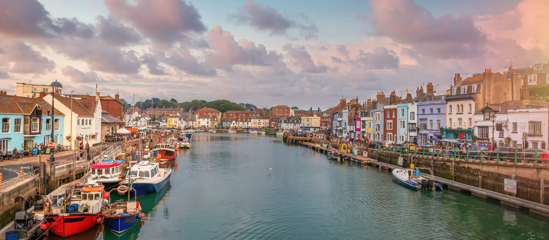
Weymouth Harbour is a narrow tidal inlet between two towns that used to be rivals, and it is still a working port. Fishing boats tie up at eye level with the pubs. A 1930 bascule bridge splits the inner water from the sea. A rowed ferry still crosses if the weather allows. The sand beach and the Georgian Esplanade are five minutes north. They are a different Weymouth.
This page is the quay. The beach and seafront article is the sand. Do not conflate them because they share a postcode.
The harbour is the mouth of the River Wey. Upstream the Roman port silted into what is now Radipole Lake. The present inlet, between the old town and Melcombe Regis, developed in the twelfth and thirteenth centuries and has a seventeenth-century waterfront.
Melcombe Regis is the north bank: Custom House Quay, the Pavilion, the beach, the Esplanade George III made fashionable. Weymouth proper is the south bank: Trinity Road, Hope Square, Brewers Quay, the climb onto the Nothe. Elizabeth I merged the two boroughs in 1571. The water between them is still the seam. You feel it when the Town Bridge is up and the two sides have to wait.
The inner harbour beyond the bridge is the marina — masts, pontoons, the backwater. The outer harbour, from the bridge down to the stone pier, is the picture: working boats, trip boats, the quays you walk. None of this is Weymouth Beach. The beach faces east into the bay. The harbour faces itself.
Custom House Quay is the north side, the Melcombe bank, the one you reach first from the Esplanade and Alexandra Gardens. Buildings from the seventeenth century onwards, painted, jammed together, pubs and seafood at street level. The harbour office is here. So is the sign for the rowing ferry.
This is where the town eats. Crab, scallops, Portland lobster when the boats have it, tables on the quay, the bridge going up in the middle of lunch. Our eating guide is the menu; this page is only saying the food is here because the boats are here.
Stand on this quay and you are looking at the Nothe side, and Nothe Fort on the headland if you know where to look. The Pavilion and the sand are behind you. That orientation is the point of a harbour hour: you have turned your back on the resort.
The Black Death entered England here. In June 1348 a ship from Gascony docked at Melcombe Regis carrying plague. There is a small memorial on the harbourside. It is easy to walk past.
Trinity Road faces Custom House Quay across the water. Hope Square and Brewers Quay sit behind it — the old brewery buildings, pubs, a square that still feels like a town rather than a front. This is the older, tighter bank.
Follow the south quay seaward and the peninsula begins. Nothe Gardens are free, wooded, and the best view in Weymouth: harbour one way, Portland the other. Nothe Fort at the point is the Victorian gun fort, 1860–72, Palmerston, seventy rooms and a ramparts walk. Ten to fifteen minutes up from the quay, and it is a hill. The fort page is the interior. The gardens do not charge.
The RNLI station and the sailing club sit toward the mouth. Keep out of the way of a shout. The stone pier is the walk if you want the harbour entrance without going up to the fort. Parking on this side is Nothe car park, already on the hill. Walk, or take the ferry. The parking guide is the map.
The Town Bridge is a twin-leaf bascule, opened in 1930 by the Duke of York, Grade II, the sixth bridge on the crossing since 1597. Each leaf weighs over two hundred tonnes and is counterbalanced so a small motor can lift it. A bell, then alarms, then the barriers. Traffic and pedestrians wait. Boats go through. A small crowd always forms. It is free, and it is the harbour’s clock.
The harbour authority publishes the timetable at weymouth-harbour.co.uk/bridgeschedule. Summer routine, 15 April to 15 September inclusive: lifts at 08:00, 10:00, 12:00, 14:00, 16:00, 18:00 and 20:00, with an extra 21:00 in June, July and August. Winter routine, 16 September to 14 April: 08:00, 10:00, 12:00, 14:00, 16:00, 18:00, and mariners need to book — a minimum of an hour’s notice, with Christmas Day and New Year’s Day shut. Air-height boards sit on both sides of the arch.
The Town Bridge does not lift on a slogan. The harbour’s own table is the one to trust, because the evening lifts are seasonal. Time a walk for a lift if you can. Missing it is not a disaster. Standing in the road while it happens is how you get a photograph of empty tarmac and a lot of sky.
A small passenger boat is still rowed across the harbour between the two quays, from the Melcombe side near the Pavilion to a landing past the sailing club and RNLI on the Nothe bank. The harbour’s own note traces rowing ferries here to the sixteenth century; the present service is the last of its kind most visitors will ever see.
It costs very little, takes two minutes, and it saves the walk round to the bridge — which matters if you are going to the fort. It runs in season and in reasonable weather. If the boat is not there, walk. Look for the “Ferry Across the Harbour” sign at the start of Custom House Quay.
Fishing boats still land here: crab, lobster, scallops, the everyday catch that the stalls sell a few metres away. Yachts, visiting masts, the occasional tall ship. Trip boats leave for Portland and along the coast in season, weather-dependent, from the quay — walk up and read the boards rather than booking a specific hour from a page written in March.
It is tidal; the inner marina beyond the bridge is a different body of water. Low water changes the picture without emptying it. High water is when the quay feels level with the decks.
Stay off working gear. Pots, ice, ladders and a boat being loaded are not a playground. Keep children back from the edge. Crabbing off the wall is a Weymouth institution — lines and bait are sold along the quay — if you pick a spot that is not a landing.
In 1944 the harbour was a D-Day embarkation point. Around half a million American troops left from Weymouth and Portland for Omaha Beach. Memorials sit on the quay.
The harbour is the south end of the resort, not a substitute for the sand.
A simple circuit: start on Custom House Quay while the boats are moving. Time a bridge lift if the board says one is due. Cross by ferry or by the bridge. Hope Square for a drink. Up to Nothe Gardens for the view; into the fort if you have the afternoon. Back along the south quay. Then, and only then, walk round to the Esplanade and the beach, which is a different light, a different noise, and a gently shelving bay the harbour never had.
Do the reverse if the children have already voted for sand: beach first, harbour when the tide of people on the front is at its worst. The two are five minutes apart and they do not feel it.
A wet version never leaves the quays. The pubs are old and small and used to weather. The rain guide has the indoor rest.
Early on a working morning, for the boats rather than the menus.
A lift of the bridge, if you can be in sight at the published hour.
Dusk, which is the photograph — masts, painted warehouses, the Nothe going dark. That is the hour the inner harbour looks like itself.
September, when the town has thinned and the harbour has not. Winter, when the inner harbour is the only place still doing a town’s work.
August Mondays at 9.30pm if you want fireworks over the bay from the Nothe rather than from the sand.
The harbour is free, open at all times, level on both quays, and the one part of Weymouth that does not need a school holiday to make sense. Walk it before the beach, or after. Just do not treat it as the beach’s wet overflow. It was here first.